

Although this winter has been historically warm and snowless, the best potential for snow we’ve seen all winter appears to be on tap for early next week.
An upper level low diving out of Canada will combine with some leftover energy off the southeast coast to create a storm Monday night into Tuesday. The track and intensity are still in flux, but given the cold air in place and the impressive nature of the upper level trough, a significant snowstorm is a serious possibility.
The setup is very complex and volatile and we expect changes in the forecast between now and then. This outlook will probably be met with a great deal of skepticism considering how late in the winter it is and how much trouble we’ve had getting snow, but after the world series, election, and superbowl, this last-minute turn of events seems fitting.
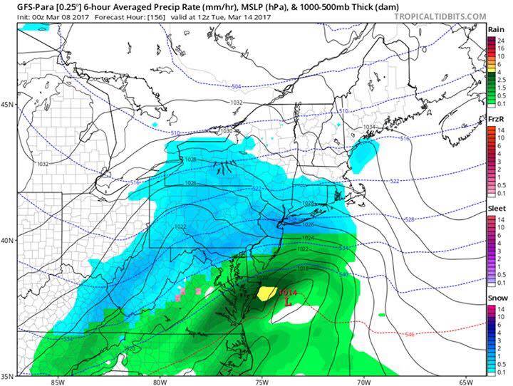
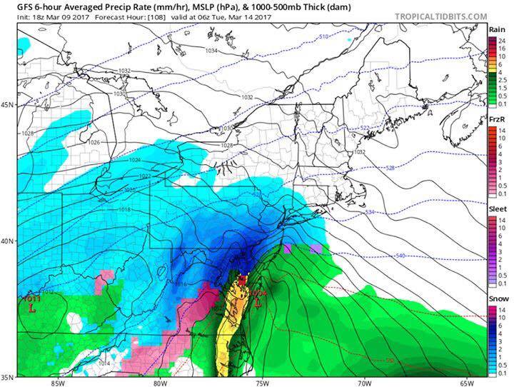
The two model runs below depict possible scenarios Monday night. The 18z GFS run from this afternoon depicts a major snowstorm with 8-16″ of accumulation, while the 0z para GFS from last night depicts an inch or so of snow mixed with rain.